Search This Blog

Saturday, May 6, 2023

Jerome, Clarkdale and Sedona

It is our last day in Arizona, we leave tomorrow to We headed back to the Verde Valley today to check out the town of Jerome.  Jerome is a city that was founded in 1899 when to ore bodies of copper was discovered.  It is located up on at hillside over 5000 feet above the valley.

This is looking from  Jerome back down at the Verde Valley. 


United Verde Mine developed by William Clark and United Verde Extension Mine, owned by James Douglas extracted copper, gold, silver and other metals from two main veins of over 1 billion dollars until 1953 when the deposits ran out.

This is the old mine site at the top of the hill


At one time there was more than 15,000 people living in Jerome but when the mines shut down, Jerome virtually became a ghost town with only 400 people remaining. The remaining residents created the Jerome Historical Society and opened the Jerome Mine Museum. They started the Ghost Town business, taking advance of the media descriptions of being declared dead. Ghost town signs were placed on both ends of town describing how Jerome once boasted a population of 15,000 with each declining number crossed out, leaving only the term “Ghost Town” As time rolled on restoration of the building progressed rapidly. In 1979 the media headlined a story: A Ghost Town Comes Back To Life and yesterdays Hippies share in credit: Hippies were credited for rebuilding old houses, starting new business and revitalizing town services. There are many high end shops with art galleries and artisans. There are number of restaurants and coffee shops, the Haunted Burger is known throughout the valley. There are also a number of historical buildings that have been restored such as the Hotel and Saloon.


From Jerome we headed back down the hill to Clarkdale, which was the site of the smelter for the copper mines.  The town was named after William Clark who built the town for the copper industry. It was Americas first company town for 7,000 people and was built for one million dollars. After the copper mine shut down the town declined to 900 people but now has turned into a retirement town.  It is also home to the Arizona Copper Art Museum.  In 1958 the Meinkes of Minnesota started a collection of copper molds and cookware.  Over the years their collection grew to such size and prominence that the family envisioned sharing their acquisitions with the public, their son Drake joined his collection with his parents and in 2000 started looking for the perfect site. Since the nickname of Arizona is the Copper State and the largest copper producer in the nation and Clarkdale having the most profound copper connection in the country was chosen.

The old high school in Clarkdale was chosen and it is a nice mix of history of the town and an amazing collection of copper art and functional items.

A wash basin

This is described as Trench Art. Soldiers during the WWI & WWII  would take the artillery shell casings that are made of brass, an alloy of copper and zinc. The expended casings were transformed into art by the soldiers in the trenches hence the name.


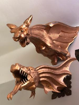
These are a few of the gargoyles 

Copper has been used in many cooking vessels and is prized by many chefs as it distributes heat evenly, cooks quickly, saves on energy, retains heat. It does however need and tin lining to stop heavy metal poisoning.

 This is a distillery and has been used for wine, beer and spirits. Copper is also know for its disinfecting properties. It is used on door knobs, railing and other objects that are touched frequently by the human hand.  A door knob that is tested initially with 10 million bacteria after 90 minutes has only .1 million bacteria vs plastic knob has 10 million bacteria to start and still has 10 million bacteria 90 minutes later.

 
After Clarkdale we headed north back to Sedona and spend the afternoon in their downtown area browsing the shops and admiring the art work.

These Javelina statues are around the town, they are wild pigs that roam the area. They are very cute. Unfortunately we never did see any live ones, I had to be content with the statues.


There are a large number of shops all along the edges of the highway and they two stories of art galleries, restaurants and lots of crystal shops. The restaurants all have very beautiful views of the red rocks around them.

This is a statue in a gallery that I managed to sneak a picture of. This artist did these amazing sculptures of  animals in traditional native attire. This is a spirit bear.

Another view from a pub.


This is a metal statue of a stag at the Indian Gardens Store in the valley between Sedona and Flagstaff


We are now getting all our laundry done and everything packed into the truck as we are leaving early tomorrow to start the journey home.






Grand Canyon East Rim

Today we headed back to the Grand Canyon to see the East Rim. We did however stop at the rock shop in Valle first. It is a neat little shop called Rocks and More. The shop itself is amazing, The amount of rocks and art pieces are plentiful. Brenda found some sample of copper, she wants to do a display with the various kinds of it. Len found out in the back some really neat crazy lace agates that were only $3 a pound so we all got a bunch of them. All around the shop they had these large metal statues that were laced out like a Wild West stagecoach robbery. 


This was a huge piece of quartz crystal that  was outside the building.


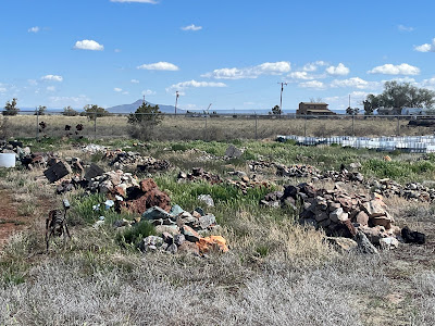
This is all the raw rocks that they had out back. Brenda found some really great pieces to slab when she gets back home.


Next stop was the Grand Canyon. It was much busier today so we were very glad that we were doing the East rim which does not get as much traffic.  Our first stop was Dessert view. This is the location of the Dessert View Watchtower.  It is a 70 ft high stone building located 25 miles to the east of the Grand Canyon Village.  The 4 story structure, completed in 1932, designed by American architect Mary Colter, who also created and designed many other buildings in the area including Hermits Rest. 


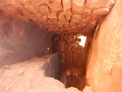
The tower was designed to resemble an Ancestral Puebloan watchtower, but its size dwarfs any known Puebloan built tower. The main space is the Kiva room in the base structure, roofed with logs that were salvaged from the old Grandview Hotel. The ceiling is a false structure concealing the the structure that supports the observation deck.  This ladder was used to come down through a smug ceremony to cleanse oneself in the smoke. 


The stairs at the back of the building lead up to the second level which is an enclosed observation level.  These murals were decorated by Fred Kabotie. 


There is also an outside observation deck from which I could see Brenda and Len down below.

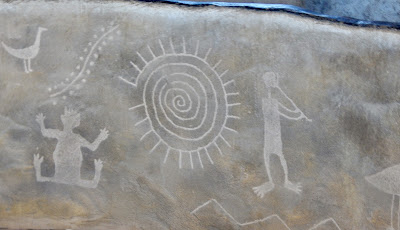
The 3rd and 4th floors are dedicated to replicas of petroglyphs and pictographs of a variety of native ruins in the southwest.


This is the ceiling looking up from the observation deck.


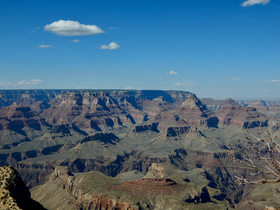
Here are a few of the views from along the rim. It was very windy that day and there was not as many railings along this area, so you had to be extra careful. There was large gust that made you loose your balance.


This was a much more relaxed day as this rim does not get as many people. The area is so large that it is difficult to do everything in one day so most people concentrate on the areas around the village. This is our second visit to the area and it was just as enjoyable as the first. It is difficult to experience the vastness of the area through pictures but hopefully we have given everyone a glimpse of the grandness of the canyon.


Thursday, May 4, 2023

Page, Horseshoe Bend, Marble Canyon & Lees Ferry

Today we headed north again up to the city of Page. Page is the location of the Glen Canyon Dam and Lake Powell.  The Dam was built from 1956 to 1966 near what became the town of Page.  It is a 710 ft high dam built by the Bureau of Reclamation and it forms Lake Powell one of the largest man made reservoirs in the US with a capacity of more than 25 million acres.  Lake Powell was named for John Wesley Powell, who in 1869 led the first expedition to traverse the Colorado River’s Grand Canyon by boat.  A dam in Glen Canyon was studied first in 1924 but the plans were dropped in favour of the Hoover Dam. It took from 1966 to 1980 for Lake Powell to reach its full capacity.  During years of drought, Glen Canyon guarantees a water deliver to the Lower Basin States of Arizona, Nevada and California, while maintaining equitable distribution of water to the Upper Basin of Colorado,, Wyoming, New Mexico and Utah and it wet years it captures e-transfer runoff for future use.  


I walked down the pathway to get that picture of the dam, thankfully there was a railing all the way down. You can see Brenda and Len in the next picture, they didn’t make the trip down. They are the ones waving.


We did head to the dam visitor centre but unfortunately it was closed.  We have been finding  some of the tourist places closing down on certain days because of staffing issues. The same thing happened at the Grand Canyon.  We tried to go the local museum but again closed, but the tourist information centre was open. They had this very neat hand carved relief map of the entire Glen Canyon Dam Area.


It took 17 years for Lake Powell which is located mainly in Utah to reach its capacity if 24,322,000 acre feet of water.  We learned that one acre feet its the equivalent of a foot ball field with a foot of water deep across the entire field. Since 2000 the area has been in a drought and the current water levels in Lake Powell are only 5,323,687 acre feet of water.  Even though this year has been a record year for snowfall they don’t really expect it to raise the level up enough to make a difference.

We then went to see Horseshoe Bend. It is a horseshoe shaped meander in the Colorado River. It is located about 5 miles from the dam and there is a 1.5 mile round trip walk to the overlook.


 It is quite spectacular to see, the pictures really don’t do it justice.  It used to be completely open but they have added railings around some of the edges so it is a bit safer.  We did see a speed boat going up river as well as some kayakers. There seems to be small camps located along the shores for people floating the river.

We then headed back towards Flagstaff and stopped at a viewpoint on the road to check out some Navajo women who were selling their jewelry. I found a very simple journey symbol with a small fire opal gem in it. The woman I purchased it from said it was a symbol of taking on new life or paths. I said that I was getting my knee replaced on June 6th so this would help me make a new path way.  I don’t really wear jewelry but Len convince me that this was a simple piece and it suited me.


We then decided to check out Marble Canyon, we saw the sign on the side of the road and decided to take it. We stopped on the side of the highway to take a couple of pictures of the red rocks and the fields of these beautiful orange flowers.


Marble Canyon is home to the Historic Navajo Bridge. This bridge was opened on Jan 12, 1929 and it was the only bridge across the  Colorado River for 600 miles and it was a vital link in the first direct highway between Arizona and Utah. At the time it was the highest steel arch bridge in the world. In 1929 this bridge replaced the Lees Ferry river crossing. It was so significant that over 5000 people attended the dedication ceremony. When the original bridge was built, it was never intended to carry the larger, heavier vehicles of today. A second bridge wider and stronger but still in keeping with the original needed to be built. They built the new bridge right beside the new one and it is hard to tell the difference.

This is the new one

This is the old one


Here are the two of them side by side


This is the Colorado River below the bridges

Our next stop was a neat little place called Hatch which has these little houses made out of rocks that have fallen off the cliff side, it is called cliff dwellings.


Our last stop was at the Lees Ferry landing. This is an area where in 1871 at the mouth of the Paris River and the Colorado river the Mormons in the area built a ferry which was operated by John Lee, the areas namesake.  It was the only crossing for miles. Thousands of pioneers crossed on the ferry on the “Honeymoon Trail” because recently married Mormons from new settlements in Arizona travelled this route to St. George, Utah to have their marriages sanctioned in the Mormon Temple.  Now it is used as the starting point for river travel through the Grand Canyon.  


There is a large parking area for people to leave their vehicles while they traverse the river and a very nice campground.