Search This Blog

Wednesday, May 3, 2023

Montezuma Castle & Tuzigoot

 So today we headed south again to the Verde Valley. We started at the casino again for breakfast, with it only be $10 each it is hard to beat.  I particularly like the fact that they have Mexican Cotija cheese, which is strong, salty white cheese that you can sprinkle on anything. It is particularly good on eggs. 

After breakfast we headed to the Montezuma Castle National Monument. 


Southern Sinagua farmers built this five-story 20 room dwelling sometime between 1100 and 1300. It occupies a cliff recess 100 feet above the valley. Early settlers marveled at the structure and assume that is was Aztec in origin, hence the name Montezuma Castle. Now Bradley deteriorated it was once an imposing five-story apartment like building with about 45 rooms. 


This diorama was built in 1955 to show people what the inside of the castle looked like. Originally they allowed people to go up inside the castle but there was too much damage being done to it so this was their alternative. Why would people build a home in a cliff face? They don’t really know for sure but they figured the proximity to water and farmland, stay above floods or for protection. Also the southern exposure that afforded winter solar heat and summer shade. A ready made shelter also meant fewer walls and roofs to construct for housing, storage, workspace, customs and rituals.

They organized and partitioned the space with walls from river cobbles and limestone held together with mud mortar. Mud plaster covered and sealed the walls. For roof beams and floors they used local sycamore that grew in the river valley as well they carried in fir and pine from a distance.

This is one of the sycamore trees that create a beautiful canopy in the area. It was like a little oasis. I thought that the bark was very interesting.

Each group living in the Castle likely had their own room, with roughly 140 square fee. Ceilings were about 5 feet and peep holes and doorways provided light in the morning and early afternoon, but rooms were dark from late afternoon on. Women and children likely did the plastering, including annual patching of exterior walls that eroded easily, their handprints  are still visible in the plaster.

When the Sinagua left the area the dwelling was meant to recycle back to earth but when the area was made into a national monument in 1906 it was preserved for present and future generations.

When they excavated the area they discovered that there was other areas in the vicinity that were most likely used for other dwellings beside the main one. You can see where other rooms were made beside the castle. It looked like there was a vibrant neighbourhood.


Though the castle may seem remote, by 1300 it was a complex network of at least 40 Verde Valley villages. Between 6,000 and 8,000 people may have live in the valley and its surrounding uplands. 

There are three monuments in this area, the second is Montezuma Well. It is a limestone sink that the Sinagua used to irrigate crops. There was about 100-150 people who lived around it. Unfortunately we were not able to visit is as there was an infestation of bees in the area so it was temporarily closed.

Our next stop was the Tuzigoot Monument. 


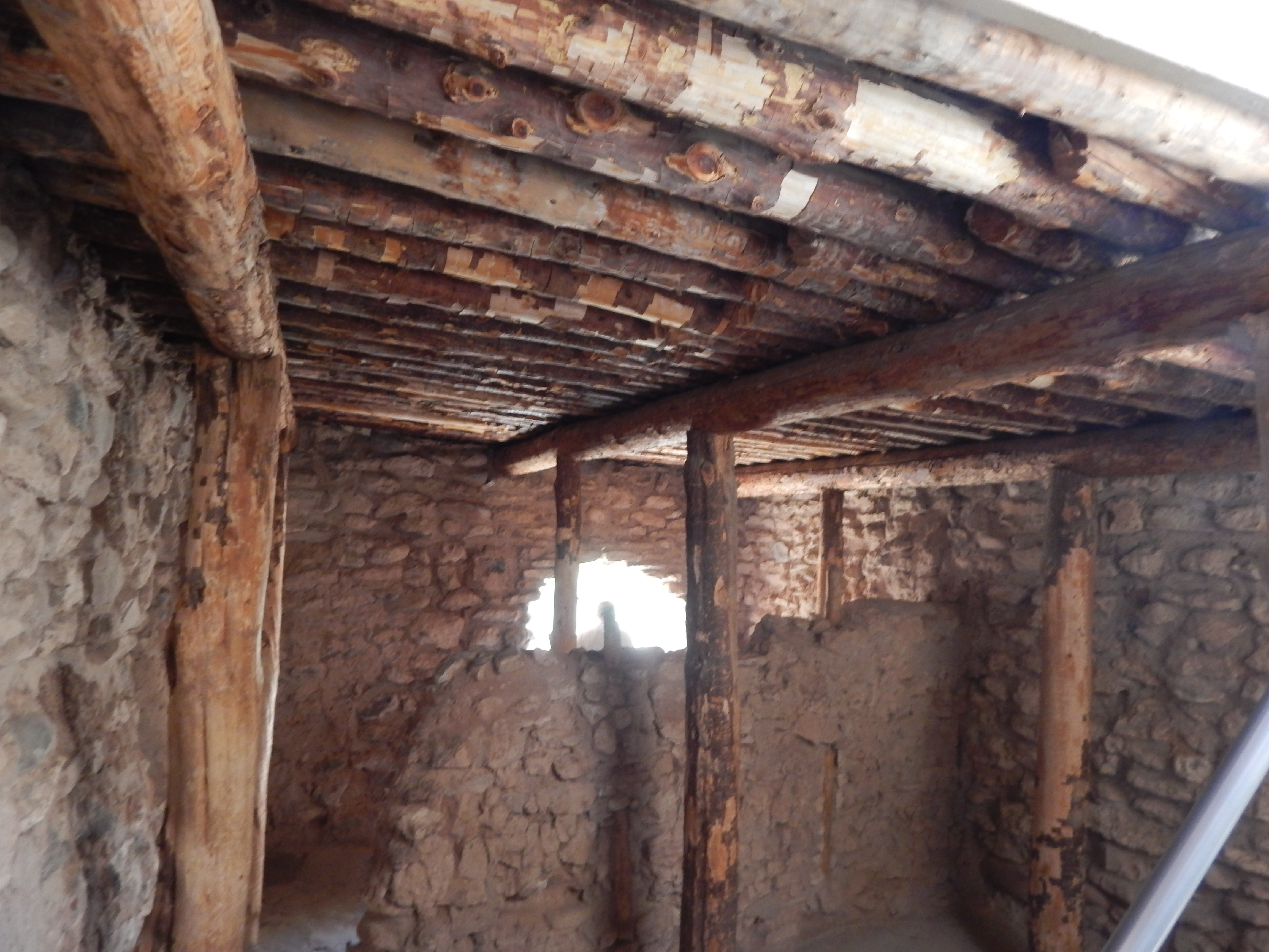
Tuzigoot is an Apache word for crooked water. It is the remnant of a Southern Sinagua village built on a summit on a long ridge rising 120 feet above the Verde Valley. the original pueblo was two stories high with 87 ground floor rooms. There were very few exterior doors, entry to the rooms was done by ladders through roof openings. They think they went through the roofs because not having doors meant that they did not have to have hallways, which meant more space for rooms. Another reason was most likely kept out animals like mice and snakes. The last reason was most likely that it helped with insulation. The room on the top was restored to its original form and in the summer when the temperature outside is over 110 degrees, the room is like it has air conditioning. 


Originally the area started out as a small cluster of rooms inhabited by about 50 people but by the 1200’s the population doubled and then doubled again.

This site was actually excavated from underneath a large pile of rubble. In 1932 many of Arizona’s copper mines closed and thousands were out of work. Nationwide unemployment was 15 million. the Tuzigoot excavation provided me and women much needed job during hard times. Local workers, with little or no experience learned to collect and preserve archeological material under the supervision of young archeology graduate students. 


As they started to excavate, rooms started to emerge on top. Workers moved more than 5000 cubic yards of earth and 20,000 cubic yards of masonry.


On its rocky perch, Tuzigoot was flanked by farming areas with extensive field systems and shelters. As the village grew over the centuries a central plaza area emerged. The plaza enclosed by rooms made the villages more pueblo like. Sister villages may have formed on local hilltops when families split off from the main village. Living on hilltops, people had a line of sight between households and also by building where they did, no farmland was sacrificed and they avoided mosquitoes and floods living next to the river.

This is the river valley below.


Teddy Roosevelt was President from 1901 to 1909, during his administration he established 5 national parks, 18 National Monuments, 150 National forests and 51 Bird Sanctuaries. He preserved 230 million acres for future generations. 


Tuesday, May 2, 2023

Monument Valley

So I am a day behind but when you do so much stuff in a day, you come home tired and it takes time to get everything you saw in order to get it all written down. So we started off earlier than usual today because the drive to monument valley is about 3 hours from Flagstaff, also they are on a different timezone and we wanted to make sure we had enough time to explore the area. We drive north on highway 89 and then turn on to highway 160, thru Tuba City to the Navaho Tribal Park. 

The entire Navajo reservation covers one third of the 130,000 square mile Colorado Plateau. The Navajo Nation, among its 29,817 square miles of endless geological wonders lies a hidden valley that John Wayne called “ Gods Treasure”. Monument Valley sits at 5,564 ft above sea level. The park extends into Arizona and Utah, about 91,696 acres. The height of the monuments range from 100 feet to 1,500 feet tall. This dry desert climate receives all four seasons. Established in 1958 as a preserved environment by the Navajo Nation Council under the Division of Natural Resources. 

This is a place where times stands still, long enough for you to feel the harmony and peace of the last western frontier. 

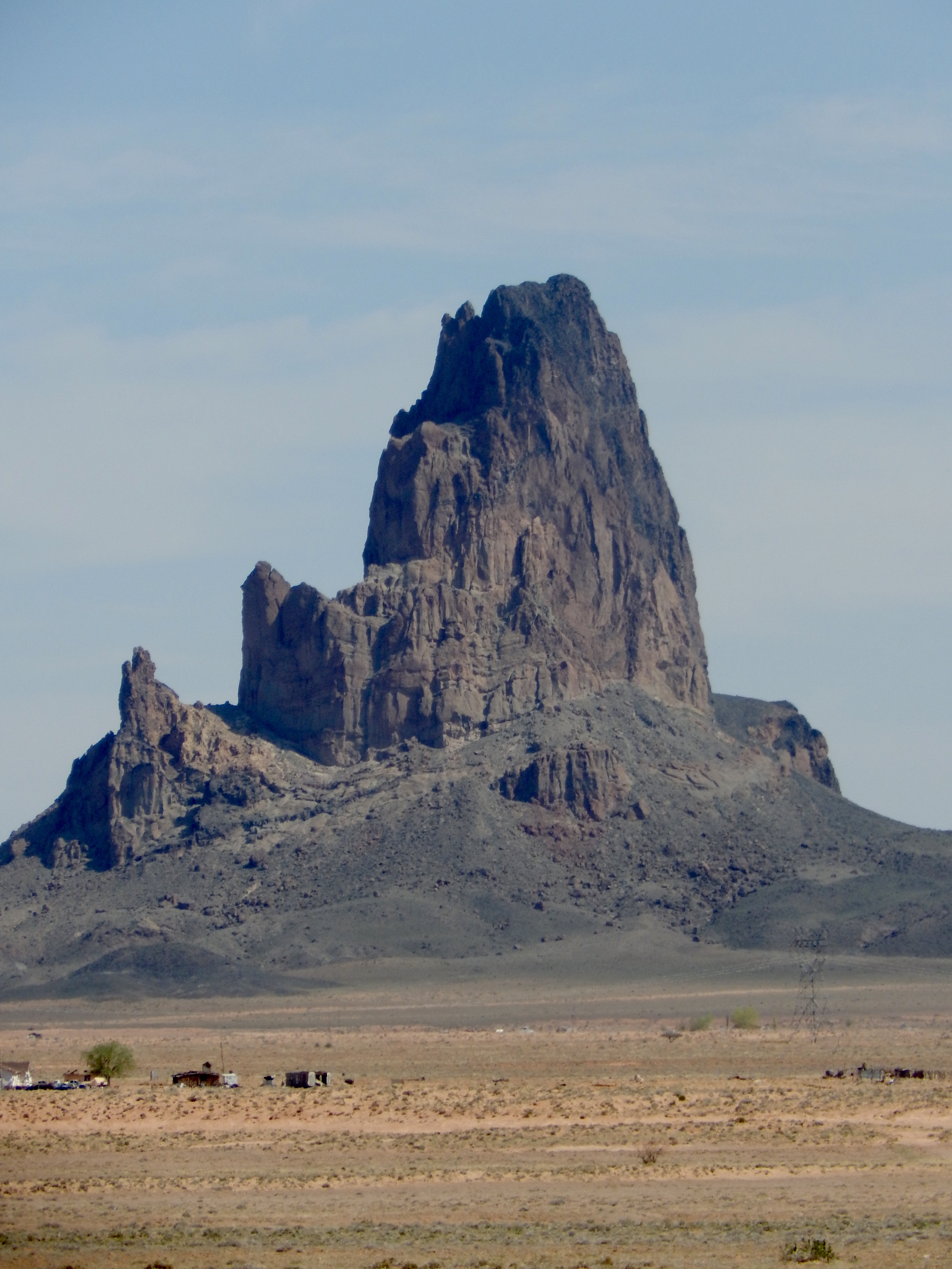
As you drive up to the park you see many monuments outside of the park. This was the first one that we saw.


This was the second, it looks like a chess piece.


This was two towers that were just outside of Tuba City.


We arrived at the park at about 11 am, paid our entrance fee and proceeded into the park to do the 17 mile driving loop around the park.  This is the first thing that you see as you start the park route. It is the East and West Mittens with the Merrick Butte on the left.


Here are closeups of the same picture. West Mitten


East Mitten


Merrick Butte


The road through the park is not paved and I am glad that we had the truck with the higher clearance. You are not allowed to take motorcycles, motor homes or trailers. It is very sandy and soft. Seeing each monument and the surrounding areas was very awe inspiring. It is very hard to explain unless you see them yourself, but hopefully the pictures give you the idea.  

The next stop was the elephant, if you look closely you can see the head and it is like there is the carriage that people ride in on top.


We stopped on the side of the road to check out some little inuksuks. It was neat to see that someone had built these.


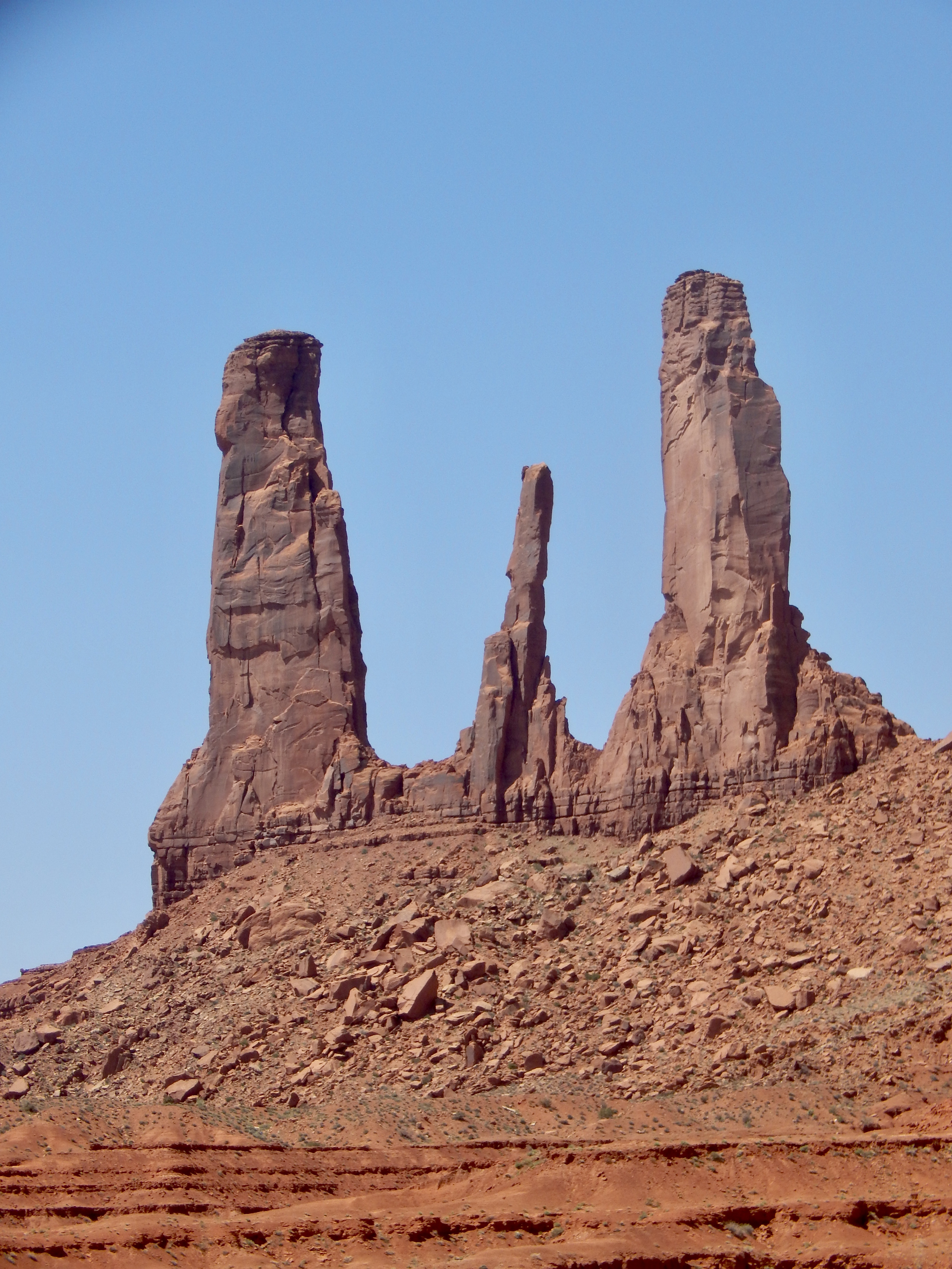
The next stop was the three sisters.


These were just before we got to John Ford’s Point. This is an area where John Ford used to film some of his movies. John Ford’s first movie in Monument valley was with John Wayne in She Wore a Yellow Ribbon. He filmed 6 movies, including My Darling Clementine. John Wayne was in 5 movies in the valley including Stagecoach and Rio Grande. The valley created an image for the world of what the Wild West was.

This is the hub, you can see mud huts and small buildings, there are still people who live in the valley. There are also horse riding areas where you can take tours around the valley. You can also take a jeep tour that will take you to places only the tours guides can go.


We did see some horses just grazing around the area, not sure if they were wild or just let loose but they were very skinny.


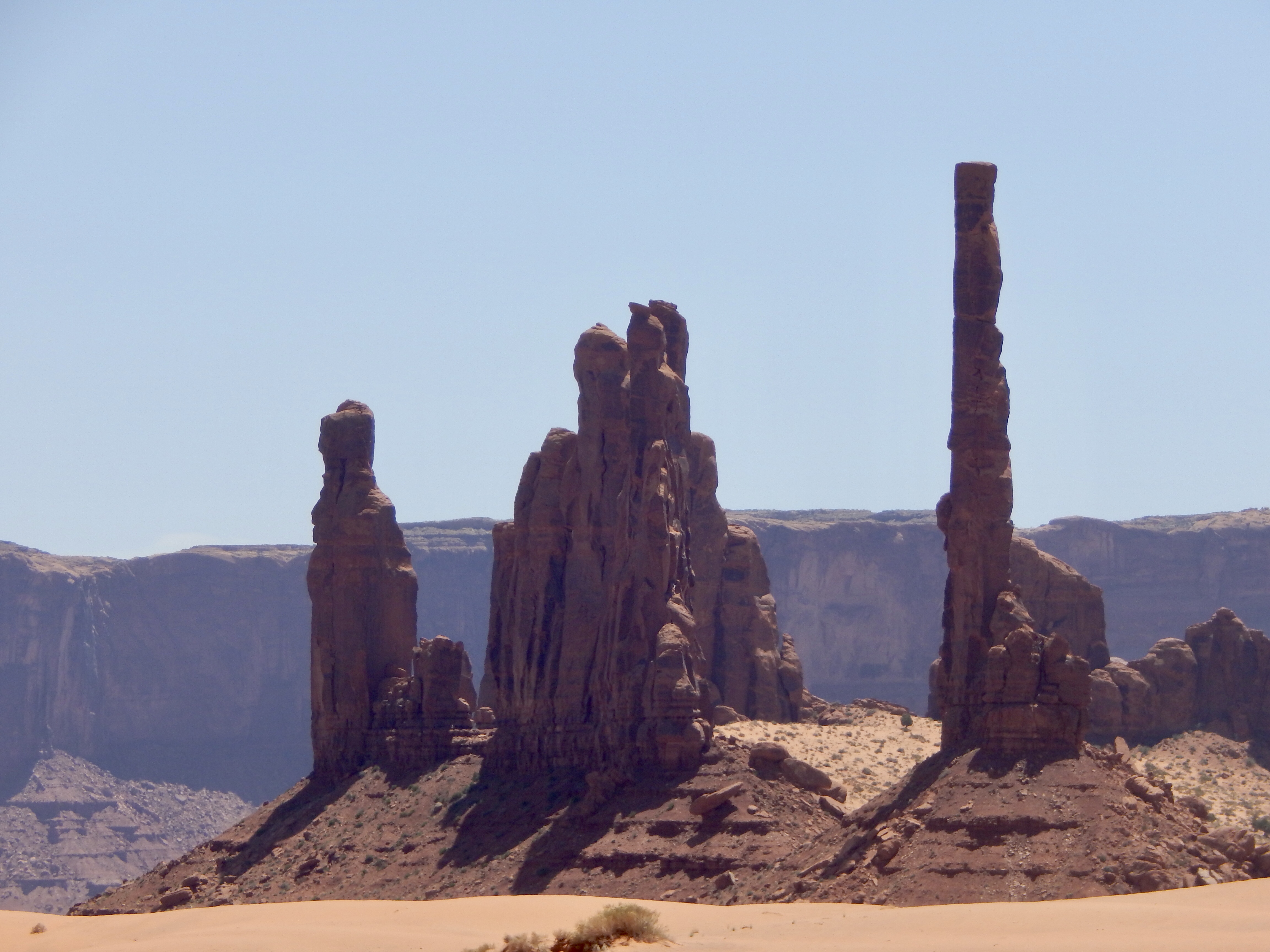
The next area was the Totem Pole and Yei Bi Chei.  You can see why they call it the totem. Yei Bi Chei in Navajo means spiritual gods and is viewed as a formation of dancers that perform for healing purposes.


Not sure what this formation was called but it looks like a candle holder and flame to me.


There are a number of Navajo vendors selling jewellery around the park. They had some very nice items and I even purchased a necklace. Considering that I don’t usually very jewellery, it was very nice.

This was taken at the Navajo Code Talker Outpost. During World War II the marines developed a complex network of nearly 400 Navajo Code Talkers. They developed over 800 code terms and provided the most sophisticated, accurate, fast and secure means of military communications. The code was used to send combat coordinates, troop movements, orders and highly classified messages. Without the accurate, secure rapid means of communications the outcome of the war in the Pacific could have been entirely different. The Navajo code as been praised as the only code in military history to never be broken by the enemy.


These last two pictures are what I call the fingers and the thumb.  They call it the thumb, they didn’t have a name for the first rocks.


It took us about 3 hours to complete the full loop, there are so many things to see and you see something different from every angle. When you are coming back to the beginning of the loop you can see the visitor centre and the hotel. Can you imagine waking up to the view in the morning.


Here are some more random pictures from around the valley. We finished the tour and then went for a late lunch at the Burger King in Kayenta. They have a code talker exhibit at the restaurant.


Monday, May 1, 2023

Wupatki & Sunset Crater Volcano National Monuments

Well we are definitely putting our US parks pass to good use. We started off our day by visiting the Wupatki National Monument.  This monument protects over 2,600 acres of ancestral Puebloan sites 20 minutes north of Sunset Crater Volcano National Monument. 

This first set of ruins are located in a box canyon. Early inhabitants constructed walk if nearby sandstone and limestone and used local soils to cement the stones together. The flat roofs were built of timbers laid side by side, covered with smaller branches and finally plastered over with mud.


Example of the timbers they used for the roofs. There was no wood large enough for the timbers so they had to travel over 50 miles to the forests around San Fransisco Peaks to get timbers large enough and they had to haul them all the way back.


This is a close up of the soil that they used for grout to stick everything together.


Doorways were small and windows almost non-existent. As the rooms ere abandoned, the Timbers were often scavenged and used in other Puebla’s or burned for firewood, a precious commodity in this environment.  The park service has stabilized these 800 year old walls to help preserve them but none were reconstructed. The walls are just has they were when they were discovered.

The visitor centre is located at Wupatki Puebla. What started out as family housing grew into this 100 room pueblo with a tower, community room and ceremonial ball court. Located near the crossroads of eas-west and north-south travel routes. This pueblo evolved to serve a community heavily engaged not only in farming but also in ceremony, trade and crafts. by 1190 as many as 2,000 people lived within a day’s walk. This was the largest building within 50 miles.


The people of the area were mainly farmers. They had to rely on special farming techniques to grow their crops in this dry, hot climate. This area received only 11 inches of rain fall on average each year. They harvested rainfall and storm small springs and seeps, but those have mainly dried up now.


This is an example of a garden that would have been planted, they used the mulch that came from the volcanic ash from the Sunset Crater Volcano. The native men would stay with the crops all summer as they did not have fences to keep animals out.  Here is an example of the corn that they would have grown.


This is what is left of the pueblo. The National parks service have fortified the walls and have done and excellent job of maintaining what has remained. You can picture a booming town center with people trading and celebrating. 


This reconstructed circular structure was used for ceremonies and used to redistribute materials and food to surrounding villagers.

Some of the rooms were used for storage of water and corn, as well as some people did live in the centre. When the national park service took over the first wardens actually stayed in the facility.


This was a bedroom area, because of the design of using different coloured rock


The wind is a powerful erosion tool, it creates these unique designs in the rock


This monument actually has two section that are linked together, after the pueblo you start to drive through the Sunset Crater part of the park. Sunset Volcano is a nearly symmetrical cinder cone formed in the mid 1080’s. This type of volcano differs from a Stratovolcano like Mount St Helens. When it erupted is covered 64,000 acres of farmland.  They estimate that the ash cloud, rose over 2.5 miles high and was visible across most of present day Arizona, New Mexico and parts of Utah. 


Lava broke out of the base and flowed for many miles, you can still see the remnants.


On April 19, 2022 a wind driven wildfire named the tunnel fire swept through the park and burned 61% of the area and grew to almost 20,000 acres in 48 hours. Luckily there was not loss of life.  You can see that the land has started to recover and large areas of grass and wildflowers are thriving. Here is an example of rabbit brush. 


At first we though they were dandelions because of the small bunches but as you can see they are a small delicate flower.


Sunset crater’s otherworldly landscape provide the perfect place to train for NASA;s Apollo Moon program. Astronauts practiced collecting rock samples and setting up scientific instruments, mapping terrain and taking scientifically useful photos. They learned to look closely at the volcanic landscape to compare it with similar features on the moon.